This is a circular walk starting in the Berkshire village of Ashampstead.
This walk is 4.5 miles and took just under 2 hours to complete.
Yattendon, the halfway point is the home to a brewey and The Royal Oak pub. The village Post Office also does take out Tea and Coffee and has a small shop.
Car Park
Parking is beside the playing fields in the middle of the village, not sure if this is called Dog Lane or Holly Lane but you can't miss them.
Co-ordinates are: 51.48849457075639, -1.187116681437046 if you look in Google Maps.
The Route
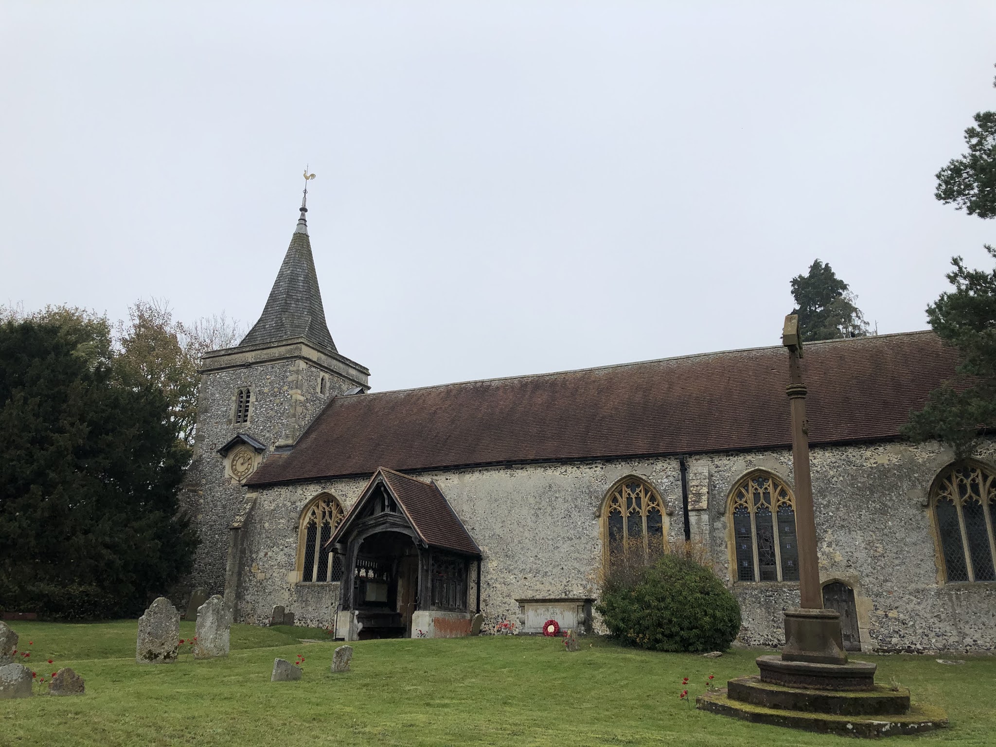
1. Facing the playing fields turn right along the road until you reach Church Lane, turn left down Church Lane until you reach the church "St Clements".

2. Enter the churchyard and follow the path round to the back of the church building to a gate in the rear fence.

3. Cross the field and you'll emerge onto a road. Turn left.
This is the road to a farm shop so will have traffic on it. Be Careful!
4. At the farm shop take the path right in front of the entrance. The path cuts through woodland and emerges at a field boundary. Continue in the hedge line path in front of you until you reach a clear area where you cross a farm track over to the opposite side.

5. Cross the field, passing a tree in the middle of the field, through a kissing gate to the other side and continue ahead crossing this next field.

6. Pass through another field until you come to a farm track, cross it and follow the path ahead with dense woodland on your left.
7. At the end of the woodland enter the next field and continue ahead keeping the hedge on your right.
8. At the end of the field follow the path left until you reach a stile in the hedge on your right, cross this stile and take the diagonal path left to the next hedgeline.
9. Cross through the hedge to follow the path right, keeping the hedge on your right until you come to an Information board about modern farming and the path turns diagonally left heading to 10 O'Clock. downhill.

10. At the end pass through the kissing gate, keep the hedge on your left through a small triangular field onto the Yattondon Road.
11. At the road turn left into Yattendon Village.
12. Pass the Royal Oak pub on your left and head to the church down Yattendon Road (essentially the same direction you've been walking on before you stopped at the pub ;-) )

13. Enter the path into the churchyard and walk through it until you reach the back hedge. There is a stile in the corner of the churchyard- cross it.
14. Follow the path from the rear of the churchyard heading right (2 O'Clock). Continue with the woods on your left until the end of the field - follow the path in the field with the hedgeline on your right.
15. At the corner of this field will be a trackway heading in four directions, continue straight - you might hear pigs in the nearby pig farm from here.
16. With the woods on your left follow the edge of the field (it bends to the right after about 600 metres).
17. Cutting through woodlands turn right down hill slightly in the shallow valley between the two fields.
18. At the end you'll join a farm track, turn left up hill.

19.This track becomes Church Lane where you started, passing St Clements Church on your left.
20 . Return to your car.
Comments
Post a Comment